Subsurface Utility Engineering and Mapping
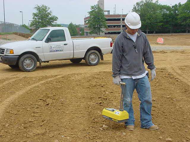
- Ground-penetrating radar (GPR)
- Radio-frequency electromagnetic methods (EM methods)
- Vacuum excavation
- 3D radar tomography (RT)
- Time-domain EM
- Magnetics
We provide thorough utility mapping to ensure you can plan and apply your budget appropriately, make accommodating schedules for any utility encountered, and have the utmost safety during construction for your crew, equipment, and property.
Why Choose CDDI?
The Benefits of Subsurface Utility Engineering with CDDI
Subsurface utility engineering has gained popularity in the last few years and has grown from a project consideration into a project necessity.
With CDDI providing your utility mapping, you will be aware of any utility concerns you may encounter during your construction, and you can plan ahead to stay prepared with minimal delays.
Utilizing subsurface utility engineering means acquiring data of where utilities are positioned underneath your work area. It is a crucial step as part of your project preparation so you can have experts on hand to provide advice, create secondary plans if you encounter any of the utilities, and stay on schedule with as minimal disruptions as possible.
Without subsurface utility engineering, you risk:
- Lengthy schedule delays when encountering unexpected utilities
- Cost increases due to rerouting and extending the construction schedule
- Safety hazards that may affect your crew, equipment, and property
- Damage to the utilities if unseen during construction
- Multiple change order requests to accommodate the utilities’ locations
The Quality Levels of Subsurface Utility Engineering
There are four main levels of subsurface utility engineering, each one focused on a particular level of risk:
Quality Level D
Quality Level C
Quality Level B
Quality Level A
You Can Count On CDDI For Your Subsurface Utility Engineering & Locating
No matter what quality level you need for your project, Capitol Development Design, Inc. is able to guide you to the most appropriate quality level and execute the subsurface utility engineering methods required.
Stay safe, save costs, and remain on schedule with subsurface utility engineering from the experienced professionals at Capitol Development Design, Inc.